
Fieldtrip The cave of La Chaise-de-Vouthon
Samedi 5 Juillet 2025
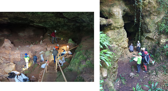
La Grotte de La Chaise-de-Vouthon se situe sur les rives de la Tardoire, affluent de la Charente, dans la commune de Vouthon. Cette grotte comprend trois abris sous roche : l’abri Suard, l’abri Bourgeois-Delaunay et l’abri Duport (renommé David-Debénath). Ces sites sont connus pour leur longue histoire des recherches, leurs grandes séquences stratigraphiques du Paléolithique Moyen, mais aussi par le fait que les abris Suard et Bourgeois-Delaunay ont livré un nombre important des restes humains néandertaliens.
Cette grotte a ainsi été exploré et fouille par différentes équipes de préhistoriens depuis 1870. Depuis 2024 une nouvelle équipe travaille sur le site avec l’objectif de comprendre et intégrer les données générées depuis le travail bibliographique et le travail sur les collections, en reprenant la main sur le terrain. Ce nouveau travail intégré des approches de l’archéologie digital pour intégrer toutes les données archéologiques dans un seul système spatial. Basé sur un modèle 3D documenté avec un scan Laser (Lidar), le projet se basse sur un référentiel topographique 3D qui récupère le référentiel des fouilles anciennes. Pourtant, ce référentiel topographique 3D permet de : i) référencer les informations archéologiques passées des fouilles de Debénath (vestiges coordonnées, anciens carroyages, anciennes coupes, anciens prélèvements pour analyses) ; ii) documenter de la manière la plus intégrée et interdisciplinaire possible, le site dans son état actuel (nouveaux levés de coupes, nouveaux échantillonnages pour datations, nouveaux vestiges).
©Diego Lopez-Onaindia
Saturday July 5, 2025
The cave of La Chaise-de-Vouthon is situated over the Tardoire valley, tributary of the Charente, in the Vouthon town. This cave currently has three rockshelters connected between them: abri Suard, abri Bourgeois-Delaunay and abri Duport (now renamed David-Debénath). These rockshelters correspond to sites that are well known because of the long history of the research on them, the long Middle Palaeolithic stratigraphic sequences, but also because of the many Neanderthal remains recovered from abri Suard and abri Bourgeois-Delaunay.
Indeed, this cave has been explored and excavated by different teams since the 1870s. Since 2024, a new team works in the site with the objective of understanding and integrating the data obtained from the bibliographic work and the study of the classical collections, with new data obtained in the field. For this purpose, the project integrates digital archaeology approaches to integrate all the archaeological data in a single spatial system. Based on a 3D model documented with a Laser scan (Lidar), this project is based over a 3D topographical reference model that recovers the references of the old excavations. Therefore, this 3D topographical model allows: i) referencing information from the old excavations by Debénath (coordinated remains, old topographical grid, stratigraphic descriptions and samplings for various analyses); ii) to document in the most possible integrated and interdisciplinary way the site in the current state and the new work (new stratigraphic descriptions, new samplings for dating, new remains).