
Plage de l’Amélie
Plage de l’Amélie, Soulac-sur-Mer, Gironde, France
[English below]
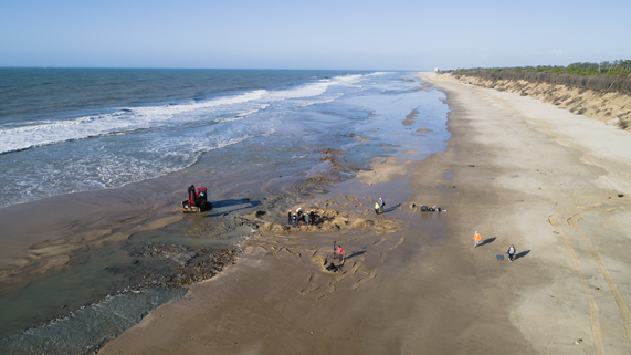
Le littoral sableux aquitain connaît une très forte érosion, particulièrement sur la commune de Soulac-sur-Mer, à l’interface entre l’estuaire de la Gironde et la côte atlantique. Il s’agit d’un milieu entre terre et eau correspondant à d’anciens marais rétro-littoraux recouverts par le massif dunaire actuel à partir de la fin de l’Antiquité.
Le trait de côte recule en moyenne de 5,5 m par an, voire de plusieurs dizaines de mètres lors des tempêtes hivernales. Ce phénomène a un impact dramatique sur le patrimoine archéologique, le long d’un linéaire côtier riche de nombreux vestiges et d’archives sédimentaires plurimillénaires.
Les recherches interdisciplinaires menées depuis 2014 se concentrent sur l’estran de la plage de l'Amélie Nord qui recèle une nappe continue de vestiges archéologiques datés du Néolithique à l'Antiquité tardive, sur 2,2 km de long par environ 200 m de large aux plus basses eaux. L’objectif est de croiser les données sur l’histoire des occupations humaines et les grandes phases d’évolution du paysage sur la longue durée, en étudiant les stratégies d’adaptation des populations à un environnement mobile.
----------------------------------------------------------------------------------------
The sandy Aquitaine coastline is experiencing very strong erosion, particularly in the town of Soulac-sur-Mer, at the interface between the Gironde Estuary and the Atlantic Coast. It is an environment between land and water corresponding to ancient retro-coastal marshes covered by the current dune massif from the end of the Antiquity.
The coastline recedes on average by 5.5 m per year, or even several tens of meters during winter storms. This phenomenon has a dramatic impact on the archaeological heritage, along a coastal stretch rich in numerous remains and multi-millennial sedimentary archives.
Interdisciplinary research carried out since 2014 has focused on the foreshore of Amélie Nord Beach, which contains a continuous layer of archaeological remains dating from the Neolithic to Late Antiquity, 2.2 km long and approximately 200 m wide. at the lowest waters. The objective is to cross-reference data on the history of human occupations and the major phases of landscape evolution over the long term, by studying the adaptation strategies of populations to a mobile environment.
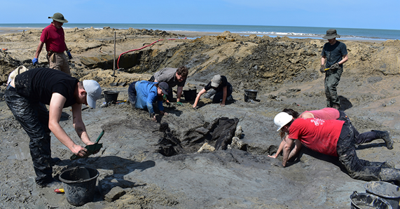
Survey and prospecting campaigns take place every winter, during high tides. They highlight salt production structures from the Neolithic and the Iron Age, occupation levels from the Bronze Age and oyster basins from the Antiquity.
References
Verdin (F.), Eynaud (F.), Stéphan (P.), Arnaud-Fassetta (G.), Bosq (M.), Bertrand (F.), Suanez (S.), Coutelier (C.), Comte (F.), Wagner (S.), Belingard (C.), Ard (V.), Manen (C.), Saint-Sever (G.) & Marchand (G.), 2019 - Humans and their environment on the Médoc coastline from the Mesolithic to the Roman period. Quaternaire, 30-1, 77-95. DOI : https://doi.org/10.4000/quaternaire.11201
Lopez-Romero (E.), Verdin (F.), Eynaud (F.), Culioli (C.), Hoffmann (A.), Huchet (J.-B.), Rollin (J.), Stéphan (P.) (2021) : Human settlement and landscape dynamics on the coastline South of the Gironde estuary (SW France): A multi-proxy approach, The Journal of Island and Coastal Archaeology, 2021, DOI: 10.1080/15564894.2021.1880505.
Researcher Contact
Florence Verdin, Ausonius